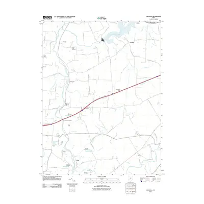
2011 Map of Oregonia
USGS Topo · Published 2011About this map
Caesar Creek Lake dominates the northern landscape of this region, where the Little Miami River snakes southward toward the settlement of Oregonia. This 2011 survey captures a mix of agricultural heritage and modern recreational infrastructure, including the Caesar Creek Gliderport and Hagemeyer Airport. A significant concentration of youth camps, such as Camp Swoneky, Camp Kern, and Camp Joy, are scattered along the river bluffs and tributaries, reflecting the area's transition into a destination for outdoor education and summer retreats.
Find a feature on this map
90 named features on this map. Tap any name to fly to it.
Don’t see what you’re looking for? This feature index may not catch every label — zoom into the map to look around manually.
Map Details
Editions of this 2011 Oregonia Map
This is the sole edition of this map. No revisions or reprints were ever made.
Other maps of this area

1907 · Blanchester
USGS Topo · 1:62,500

1913 · Waynesville
USGS Topo · 1:62,500

1914 · Morrow
USGS Topo · 1:62,500

1915 · Waynesville
USGS Topo · 1:62,500

1916 · Morrow
USGS Topo · 1:62,500

1917 · Xenia
USGS Topo · 1:62,500

1947 · Columbus
USGS Topo · 1:250,000

1953 · Cincinnati
USGS Topo · 1:250,000

1955 · New Burlington
USGS Topo · 1:24,000
1955 · Lebanon
USGS Topo · 1:24,000