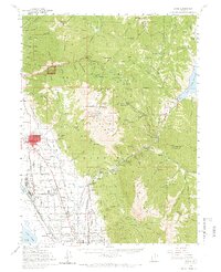
1948 Map of Orem
USGS Topo · Published 1966About this map
Mt Timpanogos dominates the center of this Utah landscape, where the high peaks of the Uinta National Forest meet the expanding agricultural and industrial corridor of the valley floor. In the late 1940s, the cities of Orem, Pleasant Grove, and Lindon show their early grid patterns alongside the Union Pacific RR and the Denver and Rio Grande Western RR. A notable concentration of industrial and civic infrastructure is visible, including a massive Steel Plant near Utah Lake and the Labor Camp to the north.
Find a feature on this map
132 named features on this map. Tap any name to fly to it.
Don’t see what you’re looking for? This feature index may not catch every label — zoom into the map to look around manually.
Map Details
Editions of this 1948 Orem Map
2 editions found
Other maps of this area

1885 · Salt Lake
USGS Topo · 1:250,000

1900 · Coalville
USGS Topo · 1:125,000

1903 · Coalville
USGS Topo · 1:125,000

1907 · Strawberry Valley
USGS Topo · 1:125,000

1909 · Strawberry Valley
USGS Topo · 1:125,000

1925 · Ft. Douglas
USGS Topo · 1:125,000

1928 · Ft. Douglas
USGS Topo · 1:125,000

1948 · Timpanogos Cave
USGS Topo · 1:24,000

1948 · Orem
USGS Topo · 1:24,000

1948 · Orem
USGS Topo · 1:62,500