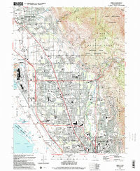
1994 Map of Orem
USGS Topo · Published 1994About this map
The massive slopes of Mount Timpanogos dominate the eastern horizon, transitioning from the high peaks of the Timpanogos Wilderness down to the bustling valley floor. This 1994 record shows the intense development of Orem and Pleasant Grove, where suburban expansion meets the critical industrial infrastructure of the Union Pacific and Denver and Rio Grande Western railroads. Along the western edge, the Powell Slough and Utah Lake shoreline provide a sharp contrast to the dense residential grids and institutional landmarks like Brigham Young University and the University Mall. The landscape is a complex network of water management, featuring the Murdock Canal, Jordan River Aqueduct, and Provo River, which together supported the rapid urbanization and agricultural legacy of this part of Utah County.
Find a feature on this map
68 named features on this map. Tap any name to fly to it.
Don’t see what you’re looking for? This feature index may not catch every label — zoom into the map to look around manually.
Map Details
Editions of this 1994 Orem Map
2 editions found
Other maps of this area

1885 · Salt Lake
USGS Topo · 1:250,000

1948 · Timpanogos Cave
USGS Topo · 1:24,000

1948 · Orem
USGS Topo · 1:24,000

1948 · Orem
USGS Topo · 1:62,500

1948 · Springville
USGS Topo · 1:24,000

1948 · Aspen Grove
USGS Topo · 1:24,000

1948 · Provo
USGS Topo · 1:24,000

1948 · Bridal Veil Falls
USGS Topo · 1:24,000

1949 · Provo
USGS Topo · 1:62,500

1950 · Orem
USGS Topo · 1:24,000