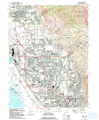
1994 Map of Orem
USGS Topo · Published 1994About this map
Orem and its neighboring communities of Pleasant Grove, Lindon, and Vineyard demonstrate the rapid urban integration of the Wasatch Front during the 1990s. The landscape is defined by the sharp transition between the residential grid and the towering Mount Timpanogos Wilderness to the east. Infrastructure follows the corridor between the mountains and Utah Lake, with the Union Pacific line and Geneva Road anchoring the industrial west side near the Bunker Grain Elevators. To the south, the map captures the extensive campus of Brigham Young University and the commercial hub around University Mall. A complex network of irrigation, including the Provo Canal and Murdock Canal, persists alongside modern developments like Scera Park and the Orem Community Hospital, reflecting the area's agricultural roots evolving into a major metropolitan center.
Find a feature on this map
95 named features on this map. Tap any name to fly to it.
Don’t see what you’re looking for? This feature index may not catch every label — zoom into the map to look around manually.
Map Details
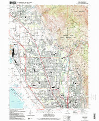
Editions of this 1994 Orem Map
2 editions found
Other maps of this area

1885 · Salt Lake
USGS Topo · 1:250,000

1948 · Timpanogos Cave
USGS Topo · 1:24,000

1948 · Orem
USGS Topo · 1:24,000

1948 · Orem
USGS Topo · 1:62,500

1948 · Springville
USGS Topo · 1:24,000

1948 · Aspen Grove
USGS Topo · 1:24,000

1948 · Provo
USGS Topo · 1:24,000

1948 · Bridal Veil Falls
USGS Topo · 1:24,000

1949 · Provo
USGS Topo · 1:62,500

1950 · Orem
USGS Topo · 1:24,000