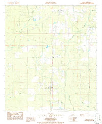
1986 Map of Oretta
USGS Topo · Published 1987About this map
The low-lying piney woods of southern Beauregard Parish are defined by the convergence of several small waterways in this mid-1980s landscape. Oretta stands as the primary community near the center of the sheet, surrounded by timber management infrastructure including numerous firebreaks and a localized Pipeline. The southern portion of the quadrangle is notably occupied by the Louisiana Correctional Institute, which is accompanied by dedicated Sewage Disposal Ponds.
Find a feature on this map
19 named features on this map. Tap any name to fly to it.
Don’t see what you’re looking for? This feature index may not catch every label — zoom into the map to look around manually.
Map Details
Editions of this 1986 Oretta Map
This is the sole edition of this map. No revisions or reprints were ever made.
Other maps of this area

1935 · Gordon
USGS Topo · 1:31,680

1947 · Singer
USGS Topo · 1:31,680

1947 · DeQuincy
USGS Topo · 1:31,680

1947 · Oretta
USGS Topo · 1:31,680

1947 · Kernan
USGS Topo · 1:31,680

1947 · Hyatt
USGS Topo · 1:31,680

1947 · Bivens
USGS Topo · 1:31,680

1947 · Beckwith School
USGS Topo · 1:31,680

1947 · Long Marsh
USGS Topo · 1:31,680

1949 · Kernan
USGS Topo · 1:31,680