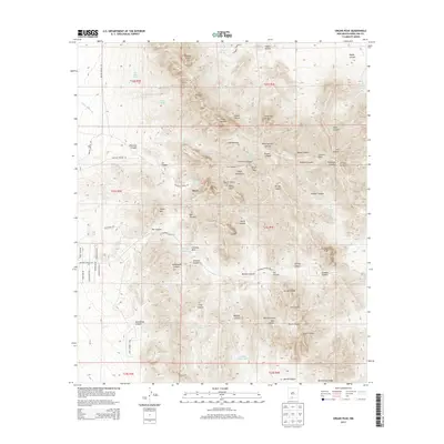
2013 Map of Organ Peak
USGS Topo · Published 2013About this map
The Needles and the towering Organ Needle anchor the high-altitude landscape of the Organ Mountains in this 2013 survey. The terrain is defined by a series of sharp, named summits including Sugarloaf Peak, Rabbit Ears, and Organ Peak, which give way to deeply etched drainages like Fillmore Canyon, Soledad Canyon, and Ice Canyon. The area’s sparse settlement is centered on Boyd, while the complex hydrology of the high desert is revealed through numerous water sources such as Mine House Spring, Aguirre Spring, and Dripping Springs. A network of unpaved access points, including Baylor Canyon Rd and Soledad Canyon Rd, provides the primary movement through these peaks. This edition provides a high-resolution look at the geographic landmarks and named tanks like Achenback Tank that supported cattle ranching and early development in this corner of Doña Ana County.
Find a feature on this map
70 named features on this map. Tap any name to fly to it.
Don’t see what you’re looking for? This feature index may not catch every label — zoom into the map to look around manually.
Map Details
Editions of this 2013 Organ Peak Map
This is the sole edition of this map. No revisions or reprints were ever made.
Other maps of this area

1891 · Las Cruces
USGS Topo · 1:125,000

1893 · Las Cruces
USGS Topo · 1:125,000

1940 · Newman
USGS Topo · 1:62,500

1941 · Organ Peak
USGS Topo · 1:62,500

1943 · La Mesa
USGS Topo · 1:62,500

1943 · Parker Lake
USGS Topo · 1:62,500

1943 · Newman
USGS Topo · 1:62,500

1943 · Organ Peak
USGS Topo · 1:62,500

1948 · Davies Tank
USGS Topo · 1:24,000

1948 · Newman NW
USGS Topo · 1:24,000