
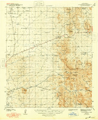
1943 Map of Organ Peak
USGS Topo · Published 1943About this map
The Organ Mountains dominate this 1941 survey of southern New Mexico, rising sharply above the desert floor of Dona Ana County. The map documents a transition from the agricultural and ranching heritage of the valley to the high peaks of Organ Needle and Organ Peak. Key landmarks of local development are visible, including the early campus of New Mexico State College and the mining outpost at Organ. Ranching life is extensively recorded through various homesteads such as the Will F. Isaacks Ranch and Dripping Spring Ranch, along with numerous isolated tanks and windmills essential for survival in the arid terrain.
Find a feature on this map
69 named features on this map. Tap any name to fly to it.
Don’t see what you’re looking for? This feature index may not catch every label — zoom into the map to look around manually.
Map Details
Editions of this 1943 Organ Peak Map
2 editions found
Other maps of this area

1891 · Las Cruces
USGS Topo · 1:125,000

1893 · Las Cruces
USGS Topo · 1:125,000

1916 · Tonuco
USGS Topo · 1:125,000

1916 · Point Of Sands
USGS Topo · 1:125,000

1932 · Tonuco
USGS Topo · 1:125,000

1940 · Newman
USGS Topo · 1:62,500

1941 · Las Cruces
USGS Topo · 1:62,500

1941 · Organ Peak
USGS Topo · 1:62,500

1943 · La Mesa
USGS Topo · 1:62,500

1943 · Parker Lake
USGS Topo · 1:62,500