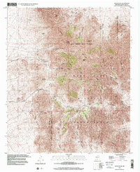
1996 Map of Organ Peak
USGS Topo · Published 2001About this map
Organ Mountains National Recreation Area dominates this mid-1990s survey, illustrating the complex overlap of public recreation lands, industrial mining history, and sprawling military jurisdiction. The sharp peaks of Organ Needle and Sugarloaf Peak rise above a landscape marked by both leisure and defense, including the Hayner Resort and the vast Fort Bliss Military Reservation.
Find a feature on this map
56 named features on this map. Tap any name to fly to it.
Don’t see what you’re looking for? This feature index may not catch every label — zoom into the map to look around manually.
Map Details
Editions of this 1996 Organ Peak Map
This is the sole edition of this map. No revisions or reprints were ever made.
Other maps of this area

1891 · Las Cruces
USGS Topo · 1:125,000

1893 · Las Cruces
USGS Topo · 1:125,000

1940 · Newman
USGS Topo · 1:62,500

1941 · Organ Peak
USGS Topo · 1:62,500

1943 · La Mesa
USGS Topo · 1:62,500

1943 · Parker Lake
USGS Topo · 1:62,500

1943 · Newman
USGS Topo · 1:62,500

1943 · Organ Peak
USGS Topo · 1:62,500

1948 · Davies Tank
USGS Topo · 1:24,000

1948 · Newman NW
USGS Topo · 1:24,000