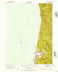
1952 Map of Orick
USGS Topo · Published 1954About this map
Prairie Creek Redwoods State Park dominates the rugged coastal landscape of northern Humboldt County in the early 1950s, preserving a narrow corridor of timber along the Redwood Highway. The settlement of Orick serves as the focal point for this region, situated near the mouth of Redwood Creek and Prairie Creek. The map documents a blend of early conservation and traditional land use, noting the State Fish Hatchery and the Elk Grove (Park Headquarters) alongside older landmarks like Hufford Ranch and Steep Village (Indian Ruins).
Find a feature on this map
34 named features on this map. Tap any name to fly to it.
Don’t see what you’re looking for? This feature index may not catch every label — zoom into the map to look around manually.
Map Details
Editions of this 1952 Orick Map
2 editions found
Other maps of this area

1922 · Preston Peak
USGS Topo · 1:125,000

1925 · Hoopa
USGS Topo · 1:125,000

1929 · Crescent City
USGS Topo · 1:125,000

1945 · Ship Mountain
USGS Topo · 1:62,500

1945 · Orick
USGS Topo · 1:62,500

1945 · Trinidad
USGS Topo · 1:62,500

1945 · Coyote Peak
USGS Topo · 1:62,500

1945 · Requa
USGS Topo · 1:62,500

1945 · Tectah Creek
USGS Topo · 1:62,500

1948 · Weed
USGS Topo · 1:250,000