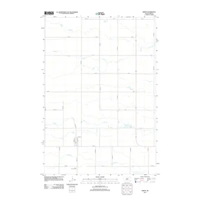
2012 Map of Orient
USGS Topo · Published 2012About this map
The small prairie settlement of Orient anchors this 2012 survey, revealing the precise layout of a rural South Dakota community. Grounded in the tradition of the American grid, the landscape is defined by long, straight sections of 355th Ave and 172nd St, which partition the drainage basins of several wandering waterways. These intermittent streams, including Bryant Cr and Gooder Cr, carve subtle paths through the terrain, while Lake Nora provides a rare concentrated water feature in the eastern section of the quadrangle. Local heritage is preserved at the Orient Prairieview Cem south of the main townsite, offering a fixed point for genealogical research. The inclusion of Railway St within the town's street plan hints at the rail-dependent history that once drove the growth of such isolated agricultural hubs.
Find a feature on this map
28 named features on this map. Tap any name to fly to it.
Don’t see what you’re looking for? This feature index may not catch every label — zoom into the map to look around manually.
Map Details
Editions of this 2012 Orient Map
This is the sole edition of this map. No revisions or reprints were ever made.
Other maps of this area

1899 · Northville
USGS Topo · 1:125,000

1899 · Redfield
USGS Topo · 1:125,000

1951 · Orient
USGS Topo · 1:24,000

1951 · Orient SW
USGS Topo · 1:24,000

1951 · Polo
USGS Topo · 1:24,000

1951 · Orient NW
USGS Topo · 1:24,000

1952 · Faulkton West
USGS Topo · 1:24,000

1952 · Faulkton East
USGS Topo · 1:24,000

1953 · Huron
USGS Topo · 1:250,000

1954 · Aberdeen
USGS Topo · 1:250,000