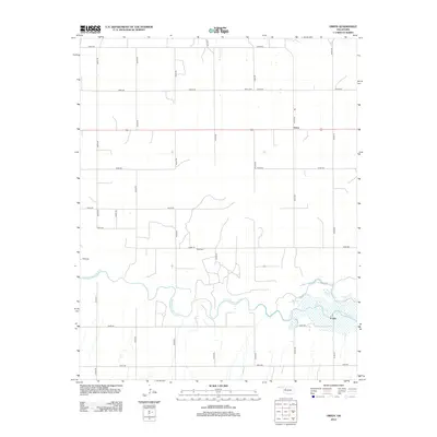
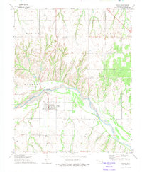
2012 Map of Orion
USGS Topo · Published 2012About this map
The North Canadian River meanders across the southern portion of this landscape, its wide floodplain and shifting channels defining the local topography. This region of Dewey County is characterized by a precise grid of rural roads, including e0540 RD and n2340 RD, which stitch together the agricultural homesteads and small communities of the early 21st century. The settlement of Orion sits at a crossroads in the northeast, while Fonda is positioned further south near the riverbanks. Local history is anchored by the Orion Cem and Hope Cem, both situated along the rural section lines. Smaller drainages like E Griever Cr feed into the larger river system, illustrating the drainage patterns essential to the area's farming and ranching economy.
Find a feature on this map
23 named features on this map. Tap any name to fly to it.
Don’t see what you’re looking for? This feature index may not catch every label — zoom into the map to look around manually.
Map Details
Editions of this 2012 Orion Map
This is the sole edition of this map. No revisions or reprints were ever made.
Other maps of this area

1955 · Woodward
USGS Topo · 1:250,000

1958 · Woodward
USGS Topo · 1:250,000
1969 · Phroso
USGS Topo · 1:24,000
1969 · Cedardale
USGS Topo · 1:24,000
1969 · Glass Mountains SW
USGS Topo · 1:24,000
1972 · Canton NW
USGS Topo · 1:24,000
1972 · Hucmac
USGS Topo · 1:24,000
1972 · Canton SW
USGS Topo · 1:24,000
1972 · Seiling
USGS Topo · 1:24,000
1972 · Taloga
USGS Topo · 1:24,000