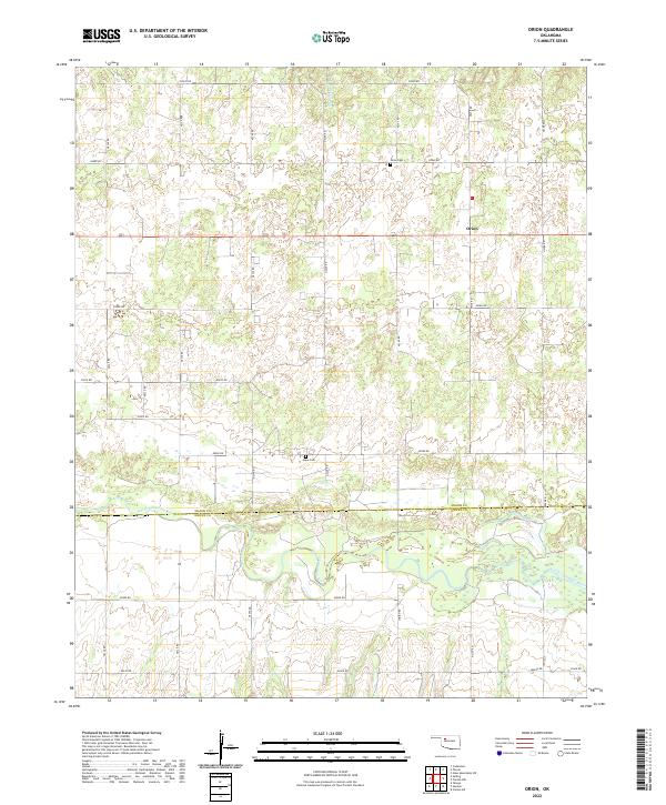
2022 Map of Orion
USGS Topo · Published 2022About this map
Orion and the surrounding plains of northwestern Oklahoma are defined by the meandering course of the North Canadian River as it crosses the boundary between Major and Dewey Counties. The settlement of Orion sits just north of the county line, surrounded by a grid of rural section roads like E0530 Rd and N2380 Rd that serve the local agricultural community. Historical burial grounds, including Orion Cem and Hope Cem, provide primary points of interest for genealogical research in this region of the Sooner State. The landscape is characterized by the river's broad floodplain and the drainage of small tributaries such as B Griever Cr, which flow through the rolling terrain of various townships, including t20n r15w and t19n r15w.
Find a feature on this map
29 named features on this map. Tap any name to fly to it.
Don’t see what you’re looking for? This feature index may not catch every label — zoom into the map to look around manually.
Map Details
Editions of this 2022 Orion Map
This is the sole edition of this map. No revisions or reprints were ever made.
Other maps of this area

1955 · Woodward
USGS Topo · 1:250,000

1958 · Woodward
USGS Topo · 1:250,000

1969 · Phroso
USGS Topo · 1:24,000

1969 · Cedardale
USGS Topo · 1:24,000

1969 · Glass Mountains SW
USGS Topo · 1:24,000

1972 · Canton NW
USGS Topo · 1:24,000

1972 · Hucmac
USGS Topo · 1:24,000

1972 · Canton SW
USGS Topo · 1:24,000

1972 · Seiling
USGS Topo · 1:24,000
1972 · Taloga
USGS Topo · 1:24,000