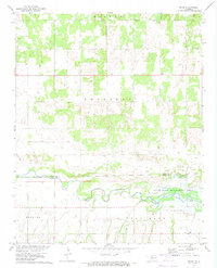
1972 Map of Orion
USGS Topo · Published 1974About this map
North Canadian River meanders across the lower portion of this quadrangle, forming a natural boundary as it flows toward the expansive Canton Lake and its associated State Game Management Area. The landscape transitions from the river valley into the township lands of Bishop, Sheridan, and Little Robe, where the small settlement of Orion serves as a local focal point. This early 1970s survey captures a rural environment defined by sectional farming and emerging energy development, evidenced by several Gas Wells scattered across the northern sections.
Find a feature on this map
14 named features on this map. Tap any name to fly to it.
Don’t see what you’re looking for? This feature index may not catch every label — zoom into the map to look around manually.
Map Details
Editions of this 1972 Orion Map
This is the sole edition of this map. No revisions or reprints were ever made.
Other maps of this area

1955 · Woodward
USGS Topo · 1:250,000

1958 · Woodward
USGS Topo · 1:250,000

1969 · Phroso
USGS Topo · 1:24,000

1969 · Cedardale
USGS Topo · 1:24,000

1969 · Glass Mountains SW
USGS Topo · 1:24,000

1972 · Canton NW
USGS Topo · 1:24,000

1972 · Hucmac
USGS Topo · 1:24,000

1972 · Canton SW
USGS Topo · 1:24,000

1972 · Seiling
USGS Topo · 1:24,000
1972 · Taloga
USGS Topo · 1:24,000