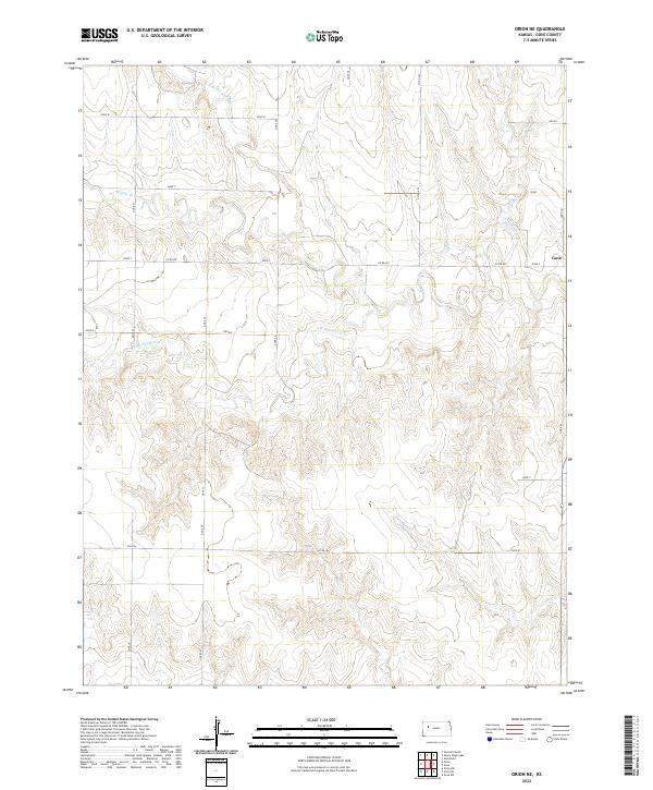
2022 Map of Orion NE
USGS Topo · Published 2022About this map
The High Plains of western Kansas are defined by the intricate drainage systems of the Hackberry Cr watershed, as seen in this 2022 survey. This specific quadrant in Gove County captures the headwaters where the N Br Hackberry Cr, Middle Br Hackberry Cr, and S Br Hackberry Cr carve through the landscape. The topographic data reveals a high-plateau environment where the terrain drops sharply into narrow creek beds, such as Indian Cr and W Spring Cr, providing a clear look at the erosional patterns of the region. The map is overlaid with a network of rural section lines, including Gove W and Gove U, which maintain the classic grid of the American West. This detailed look at the land's contours serves as a precise modern baseline for understanding the hydrology and land division in this section of the state.
Find a feature on this map
27 named features on this map. Tap any name to fly to it.
Don’t see what you’re looking for? This feature index may not catch every label — zoom into the map to look around manually.
Map Details
Editions of this 2022 Orion NE Map
This is the sole edition of this map. No revisions or reprints were ever made.
Other maps of this area

1954 · Goodland
USGS Topo · 1:250,000

1955 · Scott City
USGS Topo · 1:250,000

1956 · Goodland
USGS Topo · 1:250,000

1957 · Goodland
USGS Topo · 1:250,000

1958 · Scott City
USGS Topo · 1:250,000

1972 · Orion NE
USGS Topo · 1:24,000

1972 · Gove
USGS Topo · 1:24,000

1972 · Orion
USGS Topo · 1:24,000

1974 · Gove SW
USGS Topo · 1:24,000
1974 · Orion SE
USGS Topo · 1:24,000