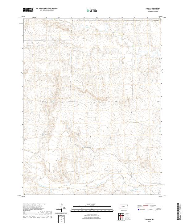
2022 Map of Orion SW
USGS Topo · Published 2022About this map
The Smoky Hill River meanders through the southern sections of this Gove County landscape, defining the local drainage patterns alongside tributaries like Hell Cr. In the northern reaches, Plum Cr cuts through the high plains, illustrating the water-driven erosion that has shaped this part of western Kansas. The map is primarily organized by a grid of rural routes, including Co Rd 22 and several designated local roads such as Gove I and Gove 24. This layout reflects the systematic land divisions of the Public Land Survey System, specifically within Townships 13S through 15S. The absence of concentrated town centers highlights the open, agricultural character of the region, where the terrain is marked by subtle elevation changes and seasonal creek beds that feed into the larger river systems.
Find a feature on this map
15 named features on this map. Tap any name to fly to it.
Don’t see what you’re looking for? This feature index may not catch every label — zoom into the map to look around manually.
Map Details
Editions of this 2022 Orion SW Map
This is the sole edition of this map. No revisions or reprints were ever made.
Other maps of this area

1939 · Sandon
USGS Topo · 1:62,500

1942 · Sandon
USGS Topo · 1:62,500

1955 · Scott City
USGS Topo · 1:250,000

1958 · Scott City
USGS Topo · 1:250,000

1972 · Orion NE
USGS Topo · 1:24,000

1972 · Orion
USGS Topo · 1:24,000

1972 · Elkader NE
USGS Topo · 1:24,000

1974 · Cheyenne Creek
USGS Topo · 1:24,000
1974 · Orion SE
USGS Topo · 1:24,000

1974 · Healy NW
USGS Topo · 1:24,000