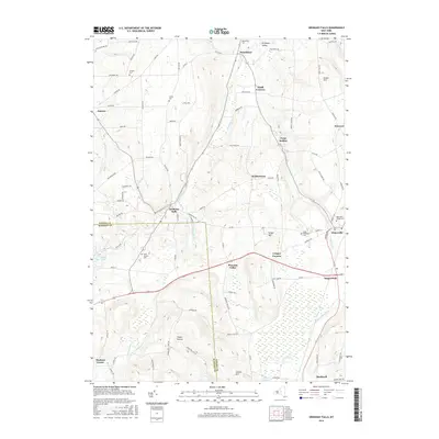
2016 Map of Oriskany Falls
USGS Topo · Published 2016About this map
Oriskany Falls and the surrounding dairy country of Oneida and Madison counties are captured here at the headwaters of Oriskany Cr. The landscape is a mix of narrow valleys and high hills, including Grant Hill and Sanger Hill, where small farming hamlets like Augusta and Deansboro follow the path of the water. This era shows the developed road network connecting historic crossroad settlements such as Forge Hollow, Small Corners, and Brothertown.
Find a feature on this map
93 named features on this map. Tap any name to fly to it.
Don’t see what you’re looking for? This feature index may not catch every label — zoom into the map to look around manually.
Map Details
Editions of this 2016 Oriskany Falls Map
This is the sole edition of this map. No revisions or reprints were ever made.
Other maps of this area

1895 · Oriskany
USGS Topo · 1:62,500

1895 · Oneida
USGS Topo · 1:62,500

1898 · Oneida
USGS Topo · 1:62,500

1898 · Oriskany
USGS Topo · 1:62,500

1902 · Morrisville
USGS Topo · 1:62,500

1902 · Oneida
USGS Topo · 1:62,500

1907 · Sangerfield
USGS Topo · 1:62,500

1939 · Oneida
USGS Topo · 1:62,500

1943 · Hubbardsville
USGS Topo · 1:24,000

1943 · Cassville
USGS Topo · 1:24,000