
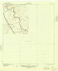
1931 Map of Orla
USGS Topo · Published 1931About this map
The Pecos River snakes through the high desert of West Texas in this 1931 edition, marking the natural boundary between Reeves Co and Loving Co. This area, surveyed in 1925, reveals a landscape defined by sparse ranching outposts and strategic rail connections. The Panhandle and Santa Fe railroad cuts across the western portion of the quadrangle, serving the small settlement of Angeles.
Find a feature on this map
9 named features on this map. Tap any name to fly to it.
Don’t see what you’re looking for? This feature index may not catch every label — zoom into the map to look around manually.
Map Details
Editions of this 1931 Orla Map
2 editions found
Other maps of this area

1925 · Orla 2-b
USGS Topo · 1:48,000

1945 · Malaga
USGS Topo · 1:62,500

1946 · Malaga
USGS Topo · 1:62,500

1954 · Carlsbad
USGS Topo · 1:250,000

1954 · Hobbs
USGS Topo · 1:250,000

1954 · Van Horn
USGS Topo · 1:250,000

1954 · Pecos
USGS Topo · 1:250,000

1957 · Pecos
USGS Topo · 1:250,000

1958 · Van Horn
USGS Topo · 1:250,000

1958 · Carlsbad
USGS Topo · 1:250,000