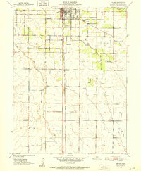
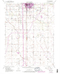
1951 Map of Orland
USGS Topo · Published 1952About this map
The town of Orland serves as the hub of this Glenn County landscape, where the Southern Pacific railroad corridor runs parallel to an emerging network of agricultural and municipal infrastructure. This early 1950s survey captures the region's managed water systems, notably the Stony Creek Irrigation Canal and numerous reservoirs that support the surrounding fields. Local history is anchored by the Price Sch and several prominent burial grounds, including the Catholic Cemetery, the I O O F Cemetery, and the Artois Cemetery further south. The map documents smaller named points such as Grapit and Greenwood alongside aviation landmarks like Haigh Landing Field. The drainage patterns of the North Fork Walker Creek and South Fork Walker Creek provide a natural contrast to the grid-like expansion of Walker Street and West Newport Road.
Find a feature on this map
23 named features on this map. Tap any name to fly to it.
Don’t see what you’re looking for? This feature index may not catch every label — zoom into the map to look around manually.
Map Details
Editions of this 1951 Orland Map
5 editions found
Other maps of this area

1904 · Vina
USGS Topo · 1:62,500

1904 · Walker Creek
USGS Topo · 1:31,680

1906 · Willows
USGS Topo · 1:62,500

1914 · Kirkwood
USGS Topo · 1:31,680

1914 · Orland
USGS Topo · 1:31,680

1914 · Hamilton
USGS Topo · 1:31,680

1914 · McIntosh Landing
USGS Topo · 1:31,680

1917 · Kurand
USGS Topo · 1:31,680

1917 · Lyman
USGS Topo · 1:31,680

1917 · Jacinto
USGS Topo · 1:31,680