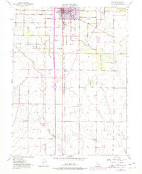
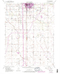
1951 Map of Orland
USGS Topo · Published 1978About this map
Orland serves as the central hub of this agricultural landscape, defined by a grid of rural roads and irrigation systems. The Southern Pacific railroad corridor bisects the town, supporting the transport of local goods during a period of steady mid-century growth. To the north, the Glenn County Fairgrounds and the Price Sch mark the social and educational corners of the community, while the outskirts are dotted with multiple gravel pits and landing strips like Haigh Landing Field.
Find a feature on this map
21 named features on this map. Tap any name to fly to it.
Don’t see what you’re looking for? This feature index may not catch every label — zoom into the map to look around manually.
Map Details
Editions of this 1951 Orland Map
5 editions found
Other maps of this area

1904 · Vina
USGS Topo · 1:62,500

1904 · Walker Creek
USGS Topo · 1:31,680

1906 · Willows
USGS Topo · 1:62,500

1914 · Kirkwood
USGS Topo · 1:31,680

1914 · Orland
USGS Topo · 1:31,680

1914 · Hamilton
USGS Topo · 1:31,680

1914 · McIntosh Landing
USGS Topo · 1:31,680

1917 · Kurand
USGS Topo · 1:31,680

1917 · Lyman
USGS Topo · 1:31,680

1917 · Jacinto
USGS Topo · 1:31,680