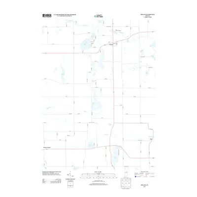
2013 Map of Orland
USGS Topo · Published 2013About this map
Orland serves as the central hub of this northern Indiana landscape, where the Fawn River and Pigeon Cr define the movement of water across a glaciated terrain. The map reveals a dense concentration of lakes, from the large expanse of Wall Lake near the northern border to smaller bodies like Green Lake and Stayner Lake further south. The presence of the Fawn River Fish Hatchery near Orland highlights a specialized use of the local hydrology, while the small settlements of Flint and Brushy Prairie mark the intersections of the rural road grid. The layout of county roads such as W Lime Lake Rd and W Bachelor Rd provides a detailed view of the 21st-century property divisions and rural infrastructure. This survey captures a pocket of Steuben County characterized by its numerous water bodies, including Tamarack Lake and Appleman Lake, which continue to shape local residence and recreation.
Find a feature on this map
61 named features on this map. Tap any name to fly to it.
Don’t see what you’re looking for? This feature index may not catch every label — zoom into the map to look around manually.
Map Details
Editions of this 2013 Orland Map
This is the sole edition of this map. No revisions or reprints were ever made.
Other maps of this area

1940 · Orland
USGS Topo · 1:24,000

1941 · Orland
USGS Topo · 1:24,000

1941 · Angola West
USGS Topo · 1:24,000

1942 · Ashley
USGS Topo · 1:24,000

1942 · Angola West
USGS Topo · 1:24,000

1942 · Stroh
USGS Topo · 1:24,000

1947 · Mongo
USGS Topo · 1:24,000

1947 · Wolcottville
USGS Topo · 1:24,000

1953 · Fort Wayne
USGS Topo · 1:250,000

1956 · Fort Wayne
USGS Topo · 1:250,000