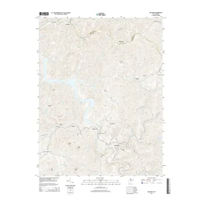
2014 Map of Orlando
USGS Topo · Published 2014About this map
Burnsville Lake dominates the central landscape of this West Virginia survey, its branching fingers reaching into the deep hollows of the Little Kanawha River basin. The historic settlement of Bulltown sits near the water’s edge, marked by the prominent Bulltown Bridge and nearby high ground like Curry Ridge. The terrain is defined by a dense network of winding ridges and watercourses, including Knawl Cr and Clover Fork, which shaped the placement of early mountain communities and small family burial grounds.
Find a feature on this map
64 named features on this map. Tap any name to fly to it.
Don’t see what you’re looking for? This feature index may not catch every label — zoom into the map to look around manually.
Map Details
Editions of this 2014 Orlando Map
This is the sole edition of this map. No revisions or reprints were ever made.
Other maps of this area

1893 · Buckhannon
USGS Topo · 1:125,000

1893 · Sutton
USGS Topo · 1:125,000

1896 · Buckhannon
USGS Topo · 1:125,000

1897 · Buckhannon
USGS Topo · 1:125,000

1906 · Burnsville
USGS Topo · 1:62,500

1908 · Sutton
USGS Topo · 1:48,000

1910 · Sutton Special
USGS Topo · 1:62,500

1912 · Crawford
USGS Topo · 1:48,000

1913 · Hacker Valley
USGS Topo · 1:48,000

1914 · Crawford
USGS Topo · 1:62,500