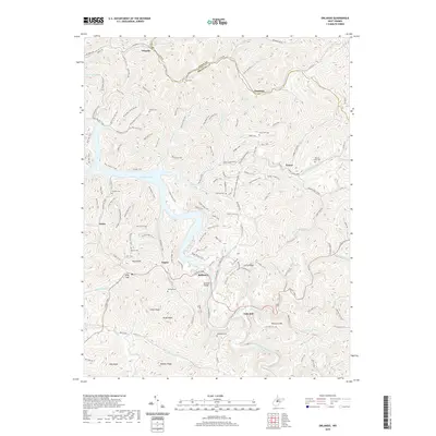
2019 Map of Orlando
USGS Topo · Published 2019About this map
Burnsville Lake dominates this central West Virginia landscape, where the waters of the Little Kanawha River system branch out into numerous runs and forks across the Lewis and Braxton county line. The map highlights a network of small, scattered communities like Orlando, Knawl, and Bulltown, connected by historic routes such as the Gauley Tpke. Genealogists will find a high density of family burial grounds, including Casto Cem, Riffle Cem, and Ratcliff Cem, which anchor the hillsides above the lake’s shoreline. The area's recreational and industrial character is evident through the extensive trail systems like the Warriors Trail and Original WGBTP Trail, alongside the presence of Gas Wells. Landmarks such as the Bulltown Bridge and the community of Falls Mill mark significant crossings and former milling sites in this deeply dissected terrain.
Find a feature on this map
130 named features on this map. Tap any name to fly to it.
Don’t see what you’re looking for? This feature index may not catch every label — zoom into the map to look around manually.
Map Details
Editions of this 2019 Orlando Map
This is the sole edition of this map. No revisions or reprints were ever made.
Other maps of this area

1893 · Buckhannon
USGS Topo · 1:125,000

1893 · Sutton
USGS Topo · 1:125,000

1896 · Buckhannon
USGS Topo · 1:125,000

1897 · Buckhannon
USGS Topo · 1:125,000

1906 · Burnsville
USGS Topo · 1:62,500

1908 · Sutton
USGS Topo · 1:48,000

1910 · Sutton Special
USGS Topo · 1:62,500

1912 · Crawford
USGS Topo · 1:48,000

1913 · Hacker Valley
USGS Topo · 1:48,000

1914 · Crawford
USGS Topo · 1:62,500