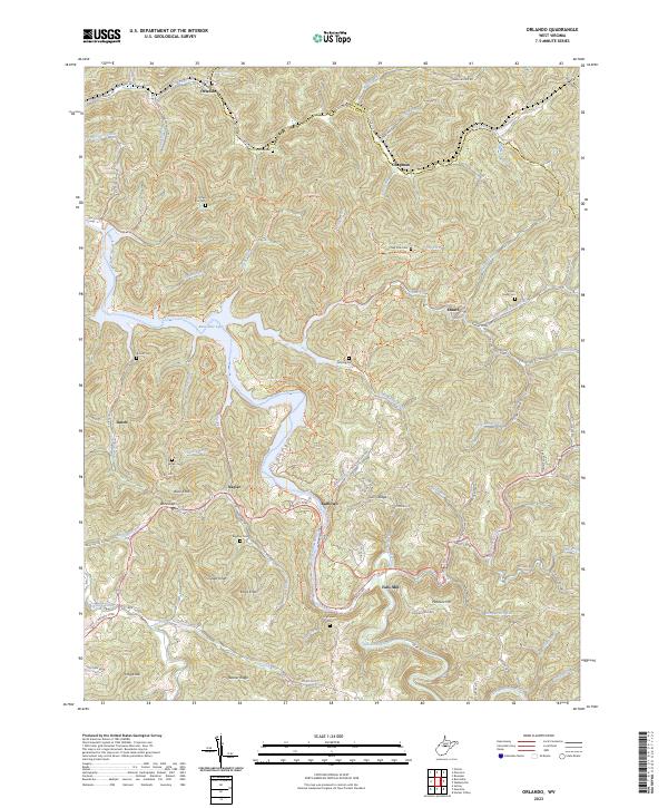
2023 Map of Orlando
USGS Topo · Published 2023About this map
Burnsville Lake dominates the central landscape of this West Virginia terrain, where the Little Kanawha River meets several tributary streams. The map reveals a dense network of early transportation routes, most notably the Gauley Turnpike and the Weston-Gauley Bridge Turnpike Trail, reflecting the area's historical role as a transit corridor through the hills. Small rural settlements like Orlando, Napier, and Bulltown are situated among high points such as Cedar Knob and Buck Knob. For family historians, the abundance of upland burial sites is remarkable, including Gasto Cemetery, Riffles Run Cemetery, and Fleming Cemetery, which sit perched above the winding waters of Henry Run and Chop Fork. The transition from river valley to ridges is sharp, defining the community layouts of Falls Mill and Knawl.
Find a feature on this map
95 named features on this map. Tap any name to fly to it.
Don’t see what you’re looking for? This feature index may not catch every label — zoom into the map to look around manually.
Map Details
Editions of this 2023 Orlando Map
This is the sole edition of this map. No revisions or reprints were ever made.
Other maps of this area

1893 · Buckhannon
USGS Topo · 1:125,000

1893 · Sutton
USGS Topo · 1:125,000

1896 · Buckhannon
USGS Topo · 1:125,000

1897 · Buckhannon
USGS Topo · 1:125,000

1906 · Burnsville
USGS Topo · 1:62,500

1908 · Sutton
USGS Topo · 1:48,000

1910 · Sutton Special
USGS Topo · 1:62,500

1912 · Crawford
USGS Topo · 1:48,000

1913 · Hacker Valley
USGS Topo · 1:48,000

1914 · Crawford
USGS Topo · 1:62,500