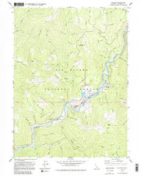
1978 Map of Orleans
USGS Topo · Published 1991About this map
Klamath River activity centers on the settlement of Orleans, where the H E Beck Jr Memorial Br provides a vital crossing within the Six Rivers National Forest. This 1970s survey captures a landscape defined by riverside infrastructure and the legacy of local extraction, including the Bonda Mine and Pearch Creek Mine. The presence of the Anderson Airstrip and scattered hillside properties like the Reece Homestead and Hunter Little Ranch illustrates the transition from traditional settlement to modern forest management and recreation. Away from the water, the terrain climbs toward Black Mountain and Sarvorum Mountain, with many small gulches and creeks such as Chimmekanee Gulch and Wilder Creek carving through the timberland. Genealogists may find interest in the isolated Cem and Grave locations marked along the river's winding path.
Find a feature on this map
65 named features on this map. Tap any name to fly to it.
Don’t see what you’re looking for? This feature index may not catch every label — zoom into the map to look around manually.
Map Details
Editions of this 1978 Orleans Map
3 editions found
Other maps of this area

1925 · Hoopa
USGS Topo · 1:125,000

1948 · Weed
USGS Topo · 1:250,000

1950 · Weed
USGS Topo · 1:250,000

1952 · Hoopa
USGS Topo · 1:62,500

1952 · Orleans
USGS Topo · 1:62,500

1955 · Salmon Mtn
USGS Topo · 1:62,500

1955 · Forks of Salmon
USGS Topo · 1:62,500

1958 · Weed
USGS Topo · 1:250,000

1963 · Weed
USGS Topo · 1:250,000

1974 · Orleans Mtn.
USGS Topo · 1:24,000