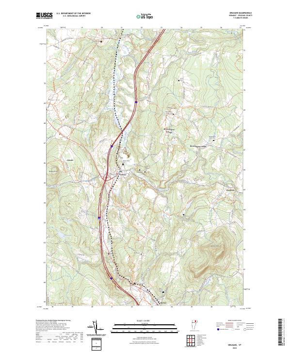
2024 Map of Orleans
USGS Topo · Published 2024About this map
The Barton River valley serves as the central artery for this part of Orleans County, defining the corridor where the village of Orleans and the town of Barton are situated. The landscape is a network of upland ridges and narrow river valleys, where the Willoughby River meets the Barton River just south of Orleans. This modern survey illustrates how settlement patterns have persisted in Vermont's Northeast Kingdom, with concentrated village centers like Brownington Village and Brownington Center remaining distinct from the surrounding agricultural and timbered highlands. Numerous small burial grounds, such as Mount Pleasant Cem and the Abbot Lot Cem, are scattered across the hillsides, offering specific points of interest for genealogists tracing family locations near Prospect Hill or along Maple Hill Rd. The map also captures the local hydrography, including Mud Pond and several brooks like Alder Brook and Hogtrough Brook that feed the primary river system.
Find a feature on this map
98 named features on this map. Tap any name to fly to it.
Don’t see what you’re looking for? This feature index may not catch every label — zoom into the map to look around manually.
Map Details
Editions of this 2024 Orleans Map
This is the sole edition of this map. No revisions or reprints were ever made.
Other maps of this area

1919 · Lake Memphremagog
USGS Topo · 1:62,500

1920 · Derby
USGS Topo · 1:62,500

1920 · Irasburg
USGS Topo · 1:62,500

1923 · Irasburg
USGS Topo · 1:48,000

1923 · Lake Memphremagog
USGS Topo · 1:48,000

1925 · Irasburg
USGS Topo · 1:62,500

1925 · Memphremagog
USGS Topo · 1:62,500

1928 · Hardwick
USGS Topo · 1:62,500

1934 · Hardwick
USGS Topo · 1:48,000

1935 · Lyndonville
USGS Topo · 1:48,000