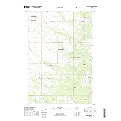
2020 Map of Orofino Mountain
USGS Topo · Published 2020About this map
Orofino Mtn and Cottonwood Mtn dominate the high-elevation landscape of this region along the border of Anaconda-Deer Lodge County. Much of the eastern and central portion of the map is protected within the Deerlodge National Forest, where a network of seasonal watercourses and drainage basins defines the topography. Notable among these are Perkins Gulch, Flume Gulch, and Telegraph Gulch, which cut through the mountain slopes towards the lower-lying valleys. The presence of numerous named gulches, including Girard Gulch and Whitcraft Gulch, points to a history of geological exploration and land use focused on the many creeks like Dry Cottonwood Cr and Orofino Cr that drain the divide between Silver Bow and Deer Lodge counties.
Find a feature on this map
33 named features on this map. Tap any name to fly to it.
Don’t see what you’re looking for? This feature index may not catch every label — zoom into the map to look around manually.
Map Details
Editions of this 2020 Orofino Mountain Map
This is the sole edition of this map. No revisions or reprints were ever made.
Other maps of this area

1889 · Helena
USGS Topo · 1:250,000

1893 · Helena
USGS Topo · 1:250,000

1899 · Helena
USGS Topo · 1:250,000

1903 · Helena
USGS Topo · 1:250,000

1947 · Butte
USGS Topo · 1:250,000

1958 · Butte
USGS Topo · 1:250,000

1959 · Butte North
USGS Topo · 1:62,500

1959 · Deer Lodge
USGS Topo · 1:62,500

1960 · Butte
USGS Topo · 1:250,000

1961 · Anaconda
USGS Topo · 1:62,500