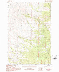
1989 Map of Orofino Mountain
USGS Topo · Published 1989About this map
Mining exploration and high-country terrain dominate the landscape along the Deer Lodge and Silver Bow county line. This 1980s provisional study captures a topography defined by complex drainage systems and intensive resource extraction, notably at the Butte Pacific Mine and numerous unnamed Prospect sites scattered across the ridges. Peaks like Orofino Mountain and Cottonwood Mountain tower over the Deerlodge National Forest, where 4WD trails provide the primary access to remote gulches.
Find a feature on this map
36 named features on this map. Tap any name to fly to it.
Don’t see what you’re looking for? This feature index may not catch every label — zoom into the map to look around manually.
Map Details
Editions of this 1989 Orofino Mountain Map
This is the sole edition of this map. No revisions or reprints were ever made.
Other maps of this area

1889 · Helena
USGS Topo · 1:250,000

1893 · Helena
USGS Topo · 1:250,000

1899 · Helena
USGS Topo · 1:250,000

1903 · Helena
USGS Topo · 1:250,000

1947 · Butte
USGS Topo · 1:250,000

1958 · Butte
USGS Topo · 1:250,000

1959 · Butte North
USGS Topo · 1:62,500

1959 · Deer Lodge
USGS Topo · 1:62,500

1960 · Butte
USGS Topo · 1:250,000

1961 · Anaconda
USGS Topo · 1:62,500