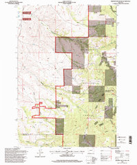
1996 Map of Orofino Mountain
USGS Topo · Published 1998About this map
Orofino Mountain and Cottonwood Mountain dominate this corner of the Deerlodge National Forest, where the landscape is etched by a series of gulches and complex mining activity. The topographic record shows a high concentration of mineral exploration along the slopes, with numerous prospects, adits, and the Butte Pacific Mine marking the terrain. These features, combined with local landmarks like Deerlodge Butte, reflect the intensive prospecting history of the boundary between Deer Lodge and Silver Bow counties.
Find a feature on this map
29 named features on this map. Tap any name to fly to it.
Don’t see what you’re looking for? This feature index may not catch every label — zoom into the map to look around manually.
Map Details
Editions of this 1996 Orofino Mountain Map
This is the sole edition of this map. No revisions or reprints were ever made.
Other maps of this area

1889 · Helena
USGS Topo · 1:250,000

1893 · Helena
USGS Topo · 1:250,000

1899 · Helena
USGS Topo · 1:250,000

1903 · Helena
USGS Topo · 1:250,000

1947 · Butte
USGS Topo · 1:250,000

1958 · Butte
USGS Topo · 1:250,000

1959 · Butte North
USGS Topo · 1:62,500

1959 · Deer Lodge
USGS Topo · 1:62,500

1960 · Butte
USGS Topo · 1:250,000

1961 · Anaconda
USGS Topo · 1:62,500