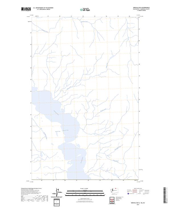
2023 Map of Oroville OE N
USGS Topo · Published 2023About this map
Osoyoos Lake and the Okanagan River define this international borderland landscape in Okanogan County. The map details the complex hydrology of the valley floor, where the small Peanut Lake sits just west of the main lake body. The surrounding terrain is a network of drainage systems, with numerous named tributaries feeding the central water system from both the east and west. Notable watercourses include Inkaneep Creek to the north and the southern reaches of Mica Creek. This 2023 edition provides a clear record of the area's natural boundaries and shoreline configurations, including the winding paths of Strawberry Creek and Rancher Creek, which are critical for understanding the local topography and riparian zones in this part of Washington.
Find a feature on this map
10 named features on this map. Tap any name to fly to it.
Don’t see what you’re looking for? This feature index may not catch every label — zoom into the map to look around manually.
Map Details
Editions of this 2023 Oroville OE N Map
This is the sole edition of this map. No revisions or reprints were ever made.
Other maps of this area

1902 · Osoyoos
USGS Topo · 1:125,000

1904 · Osoyoos
USGS Topo · 1:125,000

1906 · Chopaka
USGS Topo · 1:125,000

1954 · Okanogan
USGS Topo · 1:250,000

1956 · Loomis
USGS Topo · 1:62,500

1957 · Oroville
USGS Topo · 1:62,500

1958 · Okanogan
USGS Topo · 1:250,000

1975 · Oroville NW
USGS Topo · 1:24,000

1981 · Mount Hull
USGS Topo · 1:24,000
1982 · Oroville
USGS Topo · 1:24,000