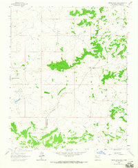
1963 Map of Orphan Annie Rock
USGS Topo · Published 1965About this map
Continental Divide winds through this high-altitude landscape in McKinley County, defining the drainage patterns of the arid terrain. The map centers on the distinctive geological landmark of Orphan Annie Rock, which lends its name to a cluster of local improvements including Orphan Annie Well and Orphan Annie Tank. These features suggest a modest ranching economy reliant on carefully managed water sources in a region dominated by intermittent watercourses like Sandoval Arroyo and Inditos Draw. The presence of the Escondido Ranch along the eastern slopes provides a specific point of interest for those researching land use and rural settlement in the early 1960s. The survey illustrates the sparse infrastructure typical of this part of New Mexico, where unimproved roads and remote wells were the primary human imprints on the land.
Find a feature on this map
8 named features on this map. Tap any name to fly to it.
Don’t see what you’re looking for? This feature index may not catch every label — zoom into the map to look around manually.
Map Details
Editions of this 1963 Orphan Annie Rock Map
2 editions found
Other maps of this area

1883 · Mt. Taylor
USGS Topo · 1:250,000

1886 · Mt. Taylor
USGS Topo · 1:250,000

1892 · Mt. Taylor
USGS Topo · 1:250,000

1899 · Mt. Taylor
USGS Topo · 1:250,000

1958 · Albuquerque
USGS Topo · 1:250,000

1961 · Piedra De La Aguila
USGS Topo · 1:24,000

1961 · Whitehorse
USGS Topo · 1:24,000

1961 · Hospah
USGS Topo · 1:24,000

1962 · Albuquerque
USGS Topo · 1:250,000
1963 · Laguna Castillo
USGS Topo · 1:24,000