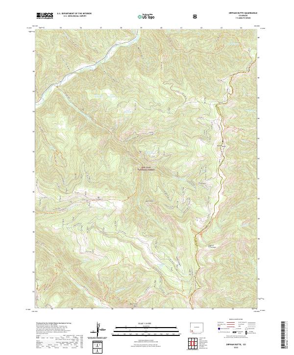
2022 Map of Orphan Butte
USGS Topo · Published 2022About this map
The San Juan National Forest defines this high-altitude landscape where the Dolores River cuts through the northern reaches. This 2022 survey details a complex network of forest trails and water management features crucial to the region's geography. Water is directed and stored in several mountain catchments, including Last Chance Reservoir, Point Reservoir, and Ridgetop Reservoir, while numerous seasonal drainages like Rough Canyon and Pasture Gulch feed into the primary river system. Distinctive geological landmarks such as Orphan Butte and Devil Point rise above the drainage basins. Cultural and recreational history is preserved in the naming of the Indian Trail and the School House Trl, reflecting the long-standing use of these routes through the Bear Creek Basin and toward Echo Park.
Find a feature on this map
54 named features on this map. Tap any name to fly to it.
Don’t see what you’re looking for? This feature index may not catch every label — zoom into the map to look around manually.
Map Details
Editions of this 2022 Orphan Butte Map
This is the sole edition of this map. No revisions or reprints were ever made.
Other maps of this area

1895 · La Plata
USGS Topo · 1:62,500

1897 · La Plata
USGS Topo · 1:62,500

1897 · Rico
USGS Topo · 1:62,500

1898 · Durango
USGS Topo · 1:62,500

1898 · Engineer Mountain
USGS Topo · 1:62,500

1898 · Rico
USGS Topo · 1:62,500

1899 · La Plata
USGS Topo · 1:62,500

1899 · Rico
USGS Topo · 1:62,500

1900 · Engineer Mountain
USGS Topo · 1:62,500

1907 · Durango
USGS Topo · 1:62,500