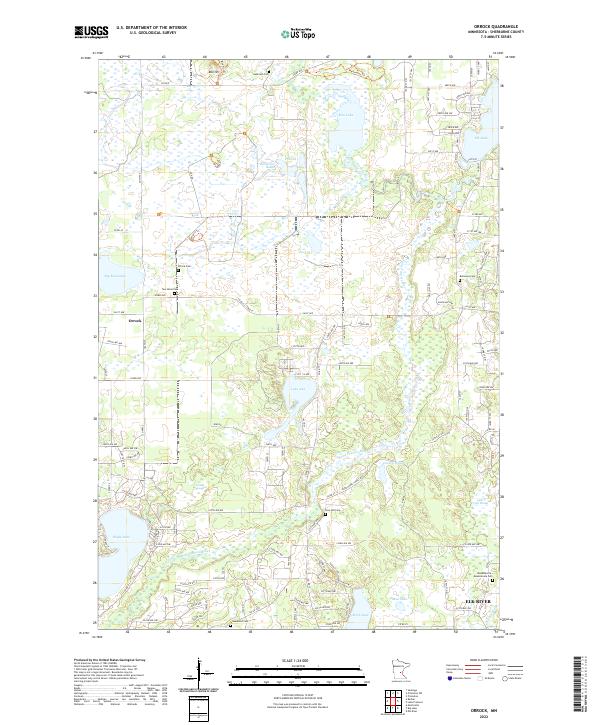
2022 Map of Orrock
USGS Topo · Published 2022About this map
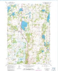
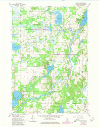
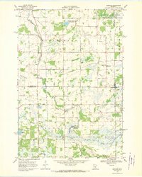
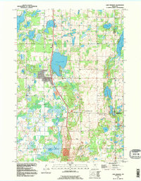
The Saint Francis River meanders through this portion of Sherburne County, defining a landscape of glacial wetlands and low-lying sloughs. The unincorporated community of Orrock sits at a crossroads in the western half of the map, surrounded by numerous small burial grounds that provide a clear record of early local families, including the Orrock Cem, Two Stone Cem, and Galbriath Cem. The terrain is characterized by intricate water systems such as Beerjerson Slough, Pool 14, and Larsen Slough, which dominate the central and northern sections.
Find a feature on this map
127 named features on this map. Tap any name to fly to it.
Don’t see what you’re looking for? This feature index may not catch every label — zoom into the map to look around manually.
Map Details
Editions of this 2022 Orrock Map
This is the sole edition of this map. No revisions or reprints were ever made.
Historical Maps of Orrock Through Time
8 maps found