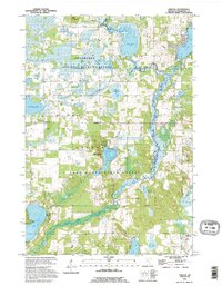
1991 Map of Orrock
USGS Topo · Published 1995About this map
Sherburne National Wildlife Refuge and Sand Dunes State Forest dominate this central Minnesota landscape, characterized by an intricate network of wetlands, sloughs, and glacial lakes. The St Francis River meanders through the eastern portion of the sheet, feeding into extensive marshlands like Beergerson Slough and Johnson Slough. This environment supported a specialized rural economy centered around the hamlet of Orrock, which serves as a focal point for the surrounding agricultural and timbered lands.
Find a feature on this map
30 named features on this map. Tap any name to fly to it.
Don’t see what you’re looking for? This feature index may not catch every label — zoom into the map to look around manually.
Map Details
Editions of this 1991 Orrock Map
This is the sole edition of this map. No revisions or reprints were ever made.
Other maps of this area

1953 · Stillwater
USGS Topo · 1:250,000

1955 · Stillwater
USGS Topo · 1:250,000

1958 · Stillwater
USGS Topo · 1:250,000

1961 · Big Lake
USGS Topo · 1:24,000

1961 · Orrock
USGS Topo · 1:24,000

1961 · Lake Fremont
USGS Topo · 1:24,000

1961 · Elk River
USGS Topo · 1:24,000

1961 · Monticello
USGS Topo · 1:24,000

1961 · Becker
USGS Topo · 1:24,000

1961 · Monticello
USGS Topo · 1:62,500