
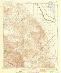
1943 Map of Ortigalita Peak
USGS Topo · Published 1943About this map
The boundary between Merced Co and San Benito Co bisects a landscape defined by cattle ranching and early irrigation infrastructure during the mid-20th century. Named family holdings like Arburua Ranch and Gaston Bide Ranch are scattered across the foothills of the Panoche De San Juan, while the Little Panoche Valley to the south reveals a network of seasonal drainages including Panoche Creek and Little Panoche Creek.
Find a feature on this map
35 named features on this map. Tap any name to fly to it.
Don’t see what you’re looking for? This feature index may not catch every label — zoom into the map to look around manually.
Map Details
Editions of this 1943 Ortigalita Peak Map
2 editions found
Other maps of this area

1913 · Panoche
USGS Topo · 1:125,000

1916 · Delta Ranch
USGS Topo · 1:24,000

1919 · San Benito
USGS Topo · 1:62,500

1920 · Pacheco Pass
USGS Topo · 1:62,500

1920 · Carrisalito Spring
USGS Topo · 1:31,680

1921 · Volta
USGS Topo · 1:31,680

1921 · Los Banos
USGS Topo · 1:31,680

1921 · Laguna Seca Ranch
USGS Topo · 1:31,680

1921 · Tierra Loma School
USGS Topo · 1:31,680

1922 · Charleston School
USGS Topo · 1:31,680