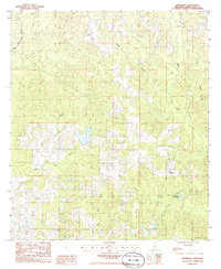
1986 Map of Orvisburg
USGS Topo · Published 1986About this map
Orvisburg serves as the primary focal point in this Pearl River County landscape, reflecting the rural character of southern Mississippi during the mid-1980s. The area is defined by a dense network of watercourses, including the prominent West Hobolochitto Creek and the curiously named Big Hell Creek. The topography is marked by numerous drainage basins and wetland features like Green Brake, which influenced the placement of local homesteads and roads. Industrial activity is indicated by a Gravel Pit located in the western portion of the quadrangle, while the local geography is anchored by water bodies such as Orvisburg Lake. The map illustrates a region where life was closely tied to the land and its waterways, with many small creeks like White Sand Creek and Hickory Creek carving through the terrain.
Find a feature on this map
12 named features on this map. Tap any name to fly to it.
Don’t see what you’re looking for? This feature index may not catch every label — zoom into the map to look around manually.
Map Details
Editions of this 1986 Orvisburg Map
This is the sole edition of this map. No revisions or reprints were ever made.
Other maps of this area

1953 · Hattiesburg
USGS Topo · 1:250,000

1953 · Mobile
USGS Topo · 1:250,000

1957 · Mobile
USGS Topo · 1:250,000

1958 · Hattiesburg
USGS Topo · 1:250,000

1958 · Carnes
USGS Topo · 1:62,500

1959 · Poplarville
USGS Topo · 1:62,500

1960 · Mobile
USGS Topo · 1:250,000

1963 · Mobile
USGS Topo · 1:250,000

1964 · Lumberton
USGS Topo · 1:24,000

1965 · Mobile
USGS Topo · 1:250,000