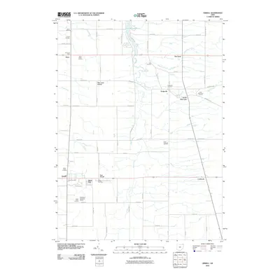
2010 Map of Orwell
USGS Topo · Published 2010About this map
Orwell and Rome anchor this corner of Ashtabula County, which remains defined by its established rural settlements and dispersed burial grounds. The landscape is characterized by a series of north-flowing waterways, including Rock Creek, Plumb Creek, and Whetstone Creek, which eventually feed into Lake Roaming Rock at the northern margin. Local community infrastructure is well-represented through multiple post offices and the Champion Executive Airport south of town. For those exploring local family histories, the map identifies numerous small cemeteries, such as Crosby Cemetery, Hyde Cemetery, and the East Brownville Cemetery. The distinct clusterings of East Orwell, South New Lyme, and Dodgeville show how the region organized around road junctions and drainage basins before modern expansion changed the footprint of these traditional farming centers.
Find a feature on this map
46 named features on this map. Tap any name to fly to it.
Don’t see what you’re looking for? This feature index may not catch every label — zoom into the map to look around manually.
Map Details
Editions of this 2010 Orwell Map
This is the sole edition of this map. No revisions or reprints were ever made.
Other maps of this area

1905 · Andover
USGS Topo · 1:48,000

1905 · Bristolville
USGS Topo · 1:62,500

1905 · Jefferson
USGS Topo · 1:62,500

1907 · Andover
USGS Topo · 1:62,500

1907 · Kinsman
USGS Topo · 1:62,500

1907 · Bristolville
USGS Topo · 1:62,500

1907 · Jefferson
USGS Topo · 1:62,500

1950 · Cleveland
USGS Topo · 1:250,000

1952 · West Farmington
USGS Topo · 1:24,000

1956 · Cleveland
USGS Topo · 1:250,000
Featured Places
- Morgan Township, OH
- Rome, OH
- Orwell, Orwell Village
- Bloomfield Township, OH
- Roaming Shores, Morgan Township