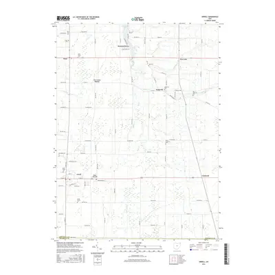
2016 Map of Orwell
USGS Topo · Published 2016About this map
The crossing of State Routes 45 and 322 serves as the anchor for the village of Orwell, a central hub in this Ashtabula County landscape. The distribution of small settlements like East Orwell, Dodgeville, and Colebrook reflects a traditional rural settlement pattern, while New Lyme Station points to the area's historical connection to rail transport. To the north, the modern residential development of Roaming Shores surrounds Lake Roaming Rock, creating a distinct contrast to the surrounding agricultural grid. This survey is particularly valuable for genealogists, as it meticulously identifies numerous local burial grounds including North Orwell Cem, South Orwell Cem, and the Rome Center Cem. The drainage of the land is defined by the winding course of Rock Creek and Shanty Cr, while man-made features like Snyder Ditch illustrate the long-standing efforts to manage the water table for local agriculture.
Find a feature on this map
88 named features on this map. Tap any name to fly to it.
Don’t see what you’re looking for? This feature index may not catch every label — zoom into the map to look around manually.
Map Details
Editions of this 2016 Orwell Map
This is the sole edition of this map. No revisions or reprints were ever made.
Other maps of this area

1905 · Andover
USGS Topo · 1:48,000

1905 · Bristolville
USGS Topo · 1:62,500

1905 · Jefferson
USGS Topo · 1:62,500

1907 · Andover
USGS Topo · 1:62,500

1907 · Kinsman
USGS Topo · 1:62,500

1907 · Bristolville
USGS Topo · 1:62,500

1907 · Jefferson
USGS Topo · 1:62,500

1950 · Cleveland
USGS Topo · 1:250,000

1952 · West Farmington
USGS Topo · 1:24,000

1956 · Cleveland
USGS Topo · 1:250,000
Featured Places
- Morgan Township, OH
- Rome, OH
- Orwell, Orwell Village
- Bloomfield Township, OH
- Roaming Shores, Morgan Township