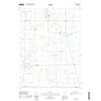
2019 Map of Orwell
USGS Topo · Published 2019About this map
Orwell and its neighboring agricultural communities in Ashtabula County anchor this landscape, where small crossroads settlements define the rural character. The map illustrates a network of local transport and water management, notably the winding courses of Rock Creek and Lebanon Creek, alongside man-made alterations like Snyder Ditch. Genealogy researchers will find significant value in the high density of burial grounds scattered across the townships, ranging from the central North Orwell Cemetery and South Orwell Cemetery to more remote locations such as Hyde Cemetery near Dodgeville. The northern portion of the map highlights the residential developments surrounding Lake Roaming Rock and the village of Roaming Shores, contrasting with the more dispersed hamlets of Rome, New Lyme, and Colebrook. These details provide a clear view of the persistent rural layout and historical land divisions of Northeast Ohio.
Find a feature on this map
63 named features on this map. Tap any name to fly to it.
Don’t see what you’re looking for? This feature index may not catch every label — zoom into the map to look around manually.
Map Details
Editions of this 2019 Orwell Map
This is the sole edition of this map. No revisions or reprints were ever made.
Other maps of this area

1905 · Andover
USGS Topo · 1:48,000

1905 · Bristolville
USGS Topo · 1:62,500

1905 · Jefferson
USGS Topo · 1:62,500

1907 · Andover
USGS Topo · 1:62,500

1907 · Kinsman
USGS Topo · 1:62,500

1907 · Bristolville
USGS Topo · 1:62,500

1907 · Jefferson
USGS Topo · 1:62,500

1950 · Cleveland
USGS Topo · 1:250,000

1952 · West Farmington
USGS Topo · 1:24,000

1956 · Cleveland
USGS Topo · 1:250,000
Featured Places
- Morgan Township, OH
- Rome, OH
- Orwell, Orwell Village
- Bloomfield Township, OH
- Roaming Shores, Morgan Township