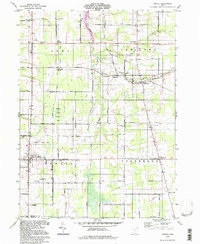
1994 Map of Orwell
USGS Topo · Published 1997About this map
The Orwell State Wildlife Area anchors the central portion of this Ashtabula County landscape, reflecting the conservation of the wet, low-lying bottomlands surrounding Rock Creek. This 1994 photo-inspection preserves the layout of the Connecticut Western Reserve's private subdivisions, where local commerce was once heavily tied to the rail corridor running through Rome Station and New Lyme Station.
Find a feature on this map
73 named features on this map. Tap any name to fly to it.
Don’t see what you’re looking for? This feature index may not catch every label — zoom into the map to look around manually.
Map Details
Editions of this 1994 Orwell Map
This is the sole edition of this map. No revisions or reprints were ever made.
Other maps of this area

1905 · Andover
USGS Topo · 1:48,000

1905 · Bristolville
USGS Topo · 1:62,500

1905 · Jefferson
USGS Topo · 1:62,500

1907 · Andover
USGS Topo · 1:62,500

1907 · Kinsman
USGS Topo · 1:62,500

1907 · Bristolville
USGS Topo · 1:62,500

1907 · Jefferson
USGS Topo · 1:62,500

1950 · Cleveland
USGS Topo · 1:250,000

1952 · West Farmington
USGS Topo · 1:24,000

1956 · Cleveland
USGS Topo · 1:250,000
Featured Places
- Morgan Township, OH
- Rome, OH
- Orwell, Orwell Village
- Bloomfield Township, OH
- Roaming Shores, Morgan Township