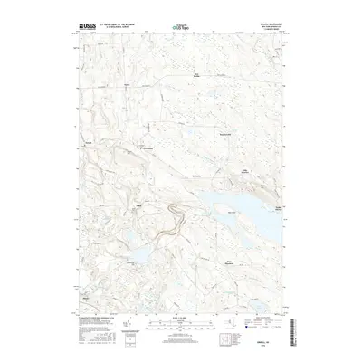
2016 Map of Orwell
USGS Topo · Published 2016About this map
The Salmon River Reservoir dominates the heart of this landscape, a significant impoundment on the Salmon River that shapes the geography of eastern Oswego County. Just downstream, the Salmon River Falls and the Lower Reservoir near Lighthouse Hill reflect a long history of water management and power generation. The surrounding uplands are dotted with small hamlets and family-named landmarks that hint at the region's agricultural and rural roots, including Beecherville, Chateaugay, and Little America.
Find a feature on this map
76 named features on this map. Tap any name to fly to it.
Don’t see what you’re looking for? This feature index may not catch every label — zoom into the map to look around manually.
Map Details
Editions of this 2016 Orwell Map
This is the sole edition of this map. No revisions or reprints were ever made.
Other maps of this area

1895 · Pulaski
USGS Topo · 1:62,500

1903 · Orwell
USGS Topo · 1:62,500

1905 · Orwell
USGS Topo · 1:62,500

1905 · Mexico
USGS Topo · 1:62,500

1906 · Kasoag
USGS Topo · 1:62,500

1942 · Sandy Creek
USGS Topo · 1:24,000

1942 · Redfield
USGS Topo · 1:24,000
1943 · Boylston
USGS Topo · 1:31,680

1943 · Redfield
USGS Topo · 1:31,680

1943 · Westdale
USGS Topo · 1:31,680