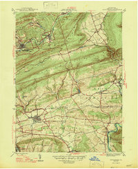
1947 Map of Orwigsburg
USGS Topo · Published 1947About this map
Orwigsburg serves as the focal point of this mid-century survey, surrounded by the industrial and transport arteries of the Pennsylvania coal region. The Schuylkill River and its tributary Silver Creek carve through the northern topography near Middleport, while the Reading railroad lines parallel the watercourses, facilitating the movement of materials between mountain ridges. To the south, the landscape transitions into the agricultural valley of West Brunswick, where local landmarks like Bethel Ch and Zion Ch stand alongside rural education centers such as Pinedale Sch.
Find a feature on this map
35 named features on this map. Tap any name to fly to it.
Don’t see what you’re looking for? This feature index may not catch every label — zoom into the map to look around manually.
Map Details
Editions of this 1947 Orwigsburg Map
2 editions found
Other maps of this area

1889 · Hazleton
USGS Topo · 1:62,500

1889 · Pottsville
USGS Topo · 1:62,500

1891 · Hazleton
USGS Topo · 1:62,500

1891 · Pottsville
USGS Topo · 1:62,500

1892 · Mahanoy
USGS Topo · 1:62,500

1893 · Hazleton
USGS Topo · 1:62,500

1893 · Mahanoy
USGS Topo · 1:62,500

1909 · Hamburg
USGS Topo · 1:62,500

1911 · Hamburg
USGS Topo · 1:62,500

1944 · Pottsville
USGS Topo · 1:24,000
Featured Places
- Orwigsburg, PA
- New Philadelphia, PA
- Deer Lake, West Brunswick Township
- Middleport, PA
- North Manheim Township, PA