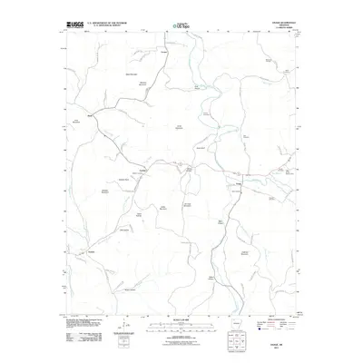
2011 Map of Osage
USGS Topo · Published 2011About this map
Osage sits at the heart of this Carroll County landscape, where the meandering course of Osage Creek dictates the local geography and historical settlement patterns. The terrain is defined by several prominent peaks, including Black Mountain, Waldrop Mountain, and Usrey Mountain, interspersed with deep hollows such as Pine Hollow and Sally Hollow. For family historians, the area is rich with genealogical data points, featuring several namesake burial sites like McGehee Cemetery, Bobo Cemetery, and Sisco Cemetery. Small rural hubs such as Conner, Rudd, and Gobbler anchor the network of county roads. The southern portion of the quadrangle is marked by the branching waters of Dry Fork and North-Fork Dry Fork, showcasing a classic Ozark drainage system before it reaches the Lake of No Return Dam.
Find a feature on this map
88 named features on this map. Tap any name to fly to it.
Don’t see what you’re looking for? This feature index may not catch every label — zoom into the map to look around manually.
Map Details
Editions of this 2011 Osage Map
This is the sole edition of this map. No revisions or reprints were ever made.
Other maps of this area

1900 · Eureka Springs
USGS Topo · 1:125,000

1901 · Eureka Springs
USGS Topo · 1:125,000

1904 · Harrison
USGS Topo · 1:125,000

1905 · Harrison
USGS Topo · 1:125,000

1945 · Harrison
USGS Topo · 1:250,000

1949 · Harrison
USGS Topo · 1:250,000

1954 · Harrison
USGS Topo · 1:250,000

1958 · Harrison
USGS Topo · 1:250,000

1964 · Harrison
USGS Topo · 1:250,000
1967 · Ponca
USGS Topo · 1:24,000