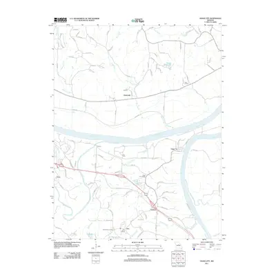
2011 Map of Osage City
USGS Topo · Published 2011About this map
The confluence of the Missouri River and Osage River dominates this landscape, where the waterways define the historical transport and settlement patterns of central Missouri. To the north of the Missouri, the community of Wainwright is situated among several drainages like Rivaux Creek and Niemans Creek, while the southern banks are home to the small river town of Osage City. This area is particularly detailed with local genealogical sites, including the Osage City Cemetery, Thorp Cemetery, and Link Cemetery.
Find a feature on this map
102 named features on this map. Tap any name to fly to it.
Don’t see what you’re looking for? This feature index may not catch every label — zoom into the map to look around manually.
Map Details
Editions of this 2011 Osage City Map
This is the sole edition of this map. No revisions or reprints were ever made.
Other maps of this area

1886 · Jefferson City
USGS Topo · 1:125,000

1888 · Tuscumbia
USGS Topo · 1:125,000

1890 · Fulton
USGS Topo · 1:125,000

1894 · Tuscumbia
USGS Topo · 1:125,000

1894 · Jefferson City
USGS Topo · 1:125,000

1934 · Linn
USGS Topo · 1:48,000

1939 · Jefferson City
USGS Topo · 1:24,000

1939 · Jefferson City
USGS Topo · 1:62,500

1942 · Jefferson City
USGS Topo · 1:62,500

1942 · Linn
USGS Topo · 1:62,500