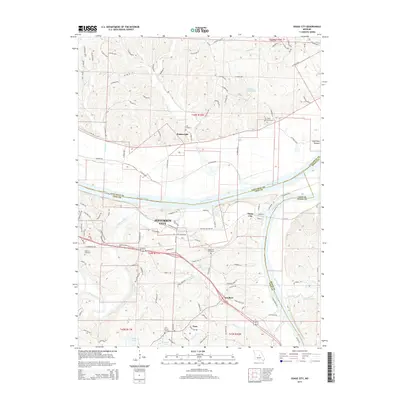
2015 Map of Osage City
USGS Topo · Published 2015About this map
The confluence of the Missouri River and the Osage River dominates this mid-2010s landscape, illustrating the complex riverine geography that defines the eastern edge of Jefferson City. The map reveals a tapestry of small settlements and rural crossroads such as Osage City, Schubert, and Taos, which are connected by a network of county roads and historic corridors.
Find a feature on this map
125 named features on this map. Tap any name to fly to it.
Don’t see what you’re looking for? This feature index may not catch every label — zoom into the map to look around manually.
Map Details
Editions of this 2015 Osage City Map
This is the sole edition of this map. No revisions or reprints were ever made.
Other maps of this area

1886 · Jefferson City
USGS Topo · 1:125,000

1888 · Tuscumbia
USGS Topo · 1:125,000

1890 · Fulton
USGS Topo · 1:125,000

1894 · Tuscumbia
USGS Topo · 1:125,000

1894 · Jefferson City
USGS Topo · 1:125,000

1934 · Linn
USGS Topo · 1:48,000

1939 · Jefferson City
USGS Topo · 1:24,000

1939 · Jefferson City
USGS Topo · 1:62,500

1942 · Jefferson City
USGS Topo · 1:62,500

1942 · Linn
USGS Topo · 1:62,500