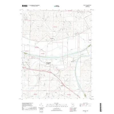
2017 Map of Osage City
USGS Topo · Published 2017About this map
The confluence of the Missouri River and the Osage River dominates this 2017 study of the Missouri heartland, revealing the intricate water systems that have shaped settlement patterns in Cole, Callaway, and Osage Counties. Jefferson City expands its eastern reach into a landscape of winding creek beds and ridges, anchored by established communities like Osage City and Taos. The terrain is marked by numerous family and community landmarks, including Saint Xaviers Cem and Thorp Cem, providing valuable points of reference for genealogists tracking local ancestry.
Find a feature on this map
131 named features on this map. Tap any name to fly to it.
Don’t see what you’re looking for? This feature index may not catch every label — zoom into the map to look around manually.
Map Details
Editions of this 2017 Osage City Map
This is the sole edition of this map. No revisions or reprints were ever made.
Other maps of this area

1886 · Jefferson City
USGS Topo · 1:125,000

1888 · Tuscumbia
USGS Topo · 1:125,000

1890 · Fulton
USGS Topo · 1:125,000

1894 · Tuscumbia
USGS Topo · 1:125,000

1894 · Jefferson City
USGS Topo · 1:125,000

1934 · Linn
USGS Topo · 1:48,000

1939 · Jefferson City
USGS Topo · 1:24,000

1939 · Jefferson City
USGS Topo · 1:62,500

1942 · Jefferson City
USGS Topo · 1:62,500

1942 · Linn
USGS Topo · 1:62,500