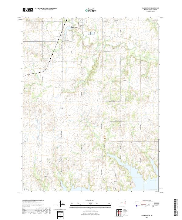
2022 Map of Osage City SE
USGS Topo · Published 2022About this map
Osage City sits at the northern edge of this Kansas landscape, where the prairie begins to transition toward the recreational waters of the south. The map document's local geography is defined by a dendritic network of streams, including Salt Cr, Mute Cr, and Turkey Cr, which drain the agricultural land before reaching the northern reaches of Melvern Lake. This reservoir dominates the southern boundary, creating a complex shoreline that contrasts with the rigid section-line road grid that organizes the rest of the county.
Find a feature on this map
41 named features on this map. Tap any name to fly to it.
Don’t see what you’re looking for? This feature index may not catch every label — zoom into the map to look around manually.
Map Details
Editions of this 2022 Osage City SE Map
This is the sole edition of this map. No revisions or reprints were ever made.
Other maps of this area

1885 · Burlington
USGS Topo · 1:125,000

1889 · Burlingame
USGS Topo · 1:125,000

1894 · Burlingame
USGS Topo · 1:125,000

1894 · Burlington
USGS Topo · 1:125,000

1947 · Lawrence
USGS Topo · 1:250,000

1950 · Lawrence
USGS Topo · 1:250,000

1956 · Lawrence
USGS Topo · 1:250,000

1957 · Lebo
USGS Topo · 1:24,000

1957 · Waverly NW
USGS Topo · 1:24,000
1957 · Lebo NW
USGS Topo · 1:24,000