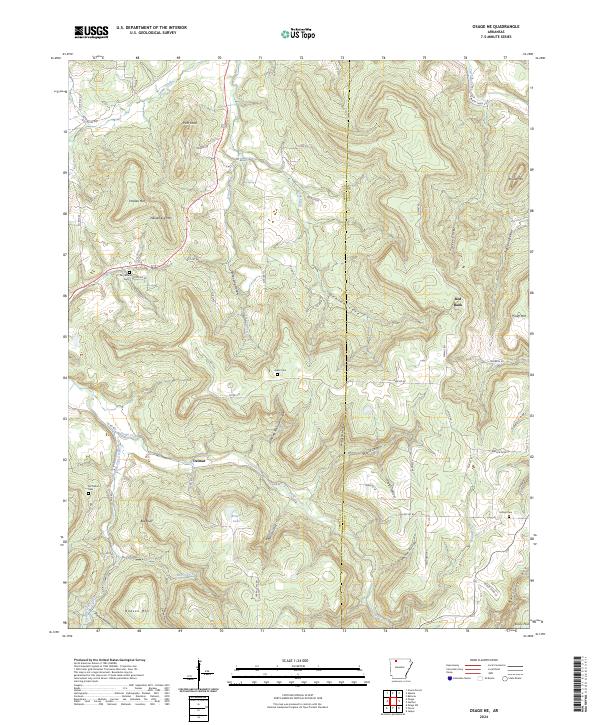
2024 Map of Osage NE
USGS Topo · Published 2024About this map
Delmar and Red Bank anchor the settlement patterns of this Ozark landscape, which is defined by the winding course of Osage Creek and its many tributaries. The area is characterized by dramatic elevation changes between high peaks like Pilot Knob and Holden Mtn and the deep, narrow hollows that feed the creek system. A network of rural county roads connects several family and community landmarks, including the Dog Branch Cem near the Dog Branch and the Mc Million Cem to the west.
Find a feature on this map
79 named features on this map. Tap any name to fly to it.
Don’t see what you’re looking for? This feature index may not catch every label — zoom into the map to look around manually.
Map Details
Editions of this 2024 Osage NE Map
This is the sole edition of this map. No revisions or reprints were ever made.
Other maps of this area

1904 · Harrison
USGS Topo · 1:125,000

1905 · Harrison
USGS Topo · 1:125,000

1945 · Harrison
USGS Topo · 1:250,000

1949 · Harrison
USGS Topo · 1:250,000

1954 · Harrison
USGS Topo · 1:250,000

1958 · Harrison
USGS Topo · 1:250,000

1964 · Harrison
USGS Topo · 1:250,000
1967 · Gaither
USGS Topo · 1:24,000
1967 · Jasper
USGS Topo · 1:24,000
1967 · Ponca
USGS Topo · 1:24,000