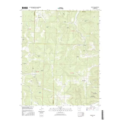
2017 Map of Osage SW
USGS Topo · Published 2017About this map
George and Stoverville occupy the drainages of the Ozark plateau where the borders of Madison, Newton, and Carroll Counties meet. The landscape is defined by deeply incised drainages like Lawson Hollow and McCullough Hollow, which feed into major watercourses such as Kenner Creek and Dry Fork. This 2017 survey illustrates the complex topography of the region, featuring prominent heights like Bradshaw Mtn and Logan Mtn that rise above the winding creek beds. In the southeast corner, the terrain transitions into the protected lands of the Buffalo National River, home to geological landmarks including the Lost Valley Natural Bridge and Eden Falls. Settlement patterns follow the valley floors and ridges, connected by a network of county roads like Co RD 103 and Fire Tower Rd, while the Hopewell Cem serves as a localized point of interest for those tracing family history in this corner of Arkansas.
Find a feature on this map
78 named features on this map. Tap any name to fly to it.
Don’t see what you’re looking for? This feature index may not catch every label — zoom into the map to look around manually.
Map Details
Editions of this 2017 Osage SW Map
This is the sole edition of this map. No revisions or reprints were ever made.
Other maps of this area

1900 · Eureka Springs
USGS Topo · 1:125,000

1901 · Eureka Springs
USGS Topo · 1:125,000

1904 · Harrison
USGS Topo · 1:125,000

1905 · Harrison
USGS Topo · 1:125,000

1945 · Harrison
USGS Topo · 1:250,000

1949 · Harrison
USGS Topo · 1:250,000

1954 · Harrison
USGS Topo · 1:250,000

1956 · Russellville
USGS Topo · 1:250,000

1958 · Harrison
USGS Topo · 1:250,000

1964 · Russellville
USGS Topo · 1:250,000