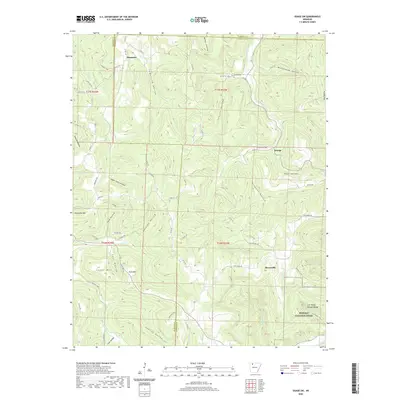
2020 Map of Osage SW
USGS Topo · Published 2020About this map
George and Stoverville anchor the high country of the Boston Mountains on this recent survey, where the topography is defined by deep hollows and prominent peaks like Logan Mtn and Arms Mtn. The landscape is a network of ridges and watercourses, including the north-flowing Kenner Creek and the southern reaches of Dry Fork. Local history is visible in the placement of the Hopewell Cem and smaller settlements like Dinsmore, which sit along the winding county roads that navigate the narrow gaps between steep terrain.
Find a feature on this map
77 named features on this map. Tap any name to fly to it.
Don’t see what you’re looking for? This feature index may not catch every label — zoom into the map to look around manually.
Map Details
Editions of this 2020 Osage SW Map
This is the sole edition of this map. No revisions or reprints were ever made.
Other maps of this area

1900 · Eureka Springs
USGS Topo · 1:125,000

1901 · Eureka Springs
USGS Topo · 1:125,000

1904 · Harrison
USGS Topo · 1:125,000

1905 · Harrison
USGS Topo · 1:125,000

1945 · Harrison
USGS Topo · 1:250,000

1949 · Harrison
USGS Topo · 1:250,000

1954 · Harrison
USGS Topo · 1:250,000

1956 · Russellville
USGS Topo · 1:250,000

1958 · Harrison
USGS Topo · 1:250,000

1964 · Russellville
USGS Topo · 1:250,000