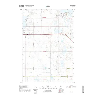
2019 Map of Osakis
USGS Topo · Published 2019About this map
The city of Osakis anchors the northern edge of this Minnesota landscape, situated at the southern tip of the expansive Lake Osakis. This modern survey reveals a complex glacial topography defined by a high concentration of small, named water bodies scattered across the rural township lines of Douglas, Todd, Stearns, and Pope Counties. To the south, a network of county and township roads like Co Rd 79 SE and W Cemetery Rd SE connect scattered farmsteads and rural landmarks, including the English Grove Cem near English Grove Lake. The map provides significant detail for genealogists and local historians, documenting the exact locations of several burial grounds such as Evergreen Cem and Calvary Cem on the outskirts of the primary settlement. The terrain transitions from the lakeside residential streets of the town to the wetland-rich basins surrounding Clifford Lake, Gulden Lake, and Burroughs Lake.
Find a feature on this map
55 named features on this map. Tap any name to fly to it.
Don’t see what you’re looking for? This feature index may not catch every label — zoom into the map to look around manually.
Map Details
Editions of this 2019 Osakis Map
This is the sole edition of this map. No revisions or reprints were ever made.
Other maps of this area

1953 · Saint Cloud
USGS Topo · 1:250,000

1957 · Saint Cloud
USGS Topo · 1:250,000

1958 · Saint Cloud
USGS Topo · 1:250,000

1965 · Westport
USGS Topo · 1:24,000

1965 · Raymond Lake
USGS Topo · 1:24,000

1966 · West Union
USGS Topo · 1:24,000

1966 · Osakis
USGS Topo · 1:24,000

1966 · Lake Osakis East
USGS Topo · 1:24,000

1966 · Lake Osakis West
USGS Topo · 1:24,000

1966 · Alexandria East
USGS Topo · 1:24,000